Drones, those small, unmanned remote controlled airplanes with cameras can now be ordered by anyone online. They freak some people out. Not everyone loves the idea of a drone honing in on you in your backyard, but in agriculture, forestry and even in conservation they are the hot topic of the year. How can we make the most of drones to better food production, and help our planet?
Consider that Abu Dhabi is already using drones to train eagles, and for conservation efforts, but Abu Dhabi has banned drones for recreational use. American and European farmers are already enjoying the remote control possibilities of “seeing” their crop from the office at the farmhouse.
But just sending out a drone to man the fields doesn’t solve the bigger questions: what to do with all the footage, and how to make smart decisions from the hours of data collected?
Two wonder whizzes from Israel have the key. Robi Stark, the CEO of Sensilize, and his partner Yoav Zur are experienced scientists that understand imaging data. They’ve both done PhD level work in the area long before going on to work in remote sensing for defense companies like Elbit Systems. In recent years they decided that they wanted to make an impact on this world and set themselves on a year-long journey studying what’s missing in agriculture.
After buying their own drone and then realizing the legal framework for flying the vehicles is rife with complications – from the United States to Europe to Asia – they understood that a tool for drones, to help them collect better data, would scale their skills and expertise.
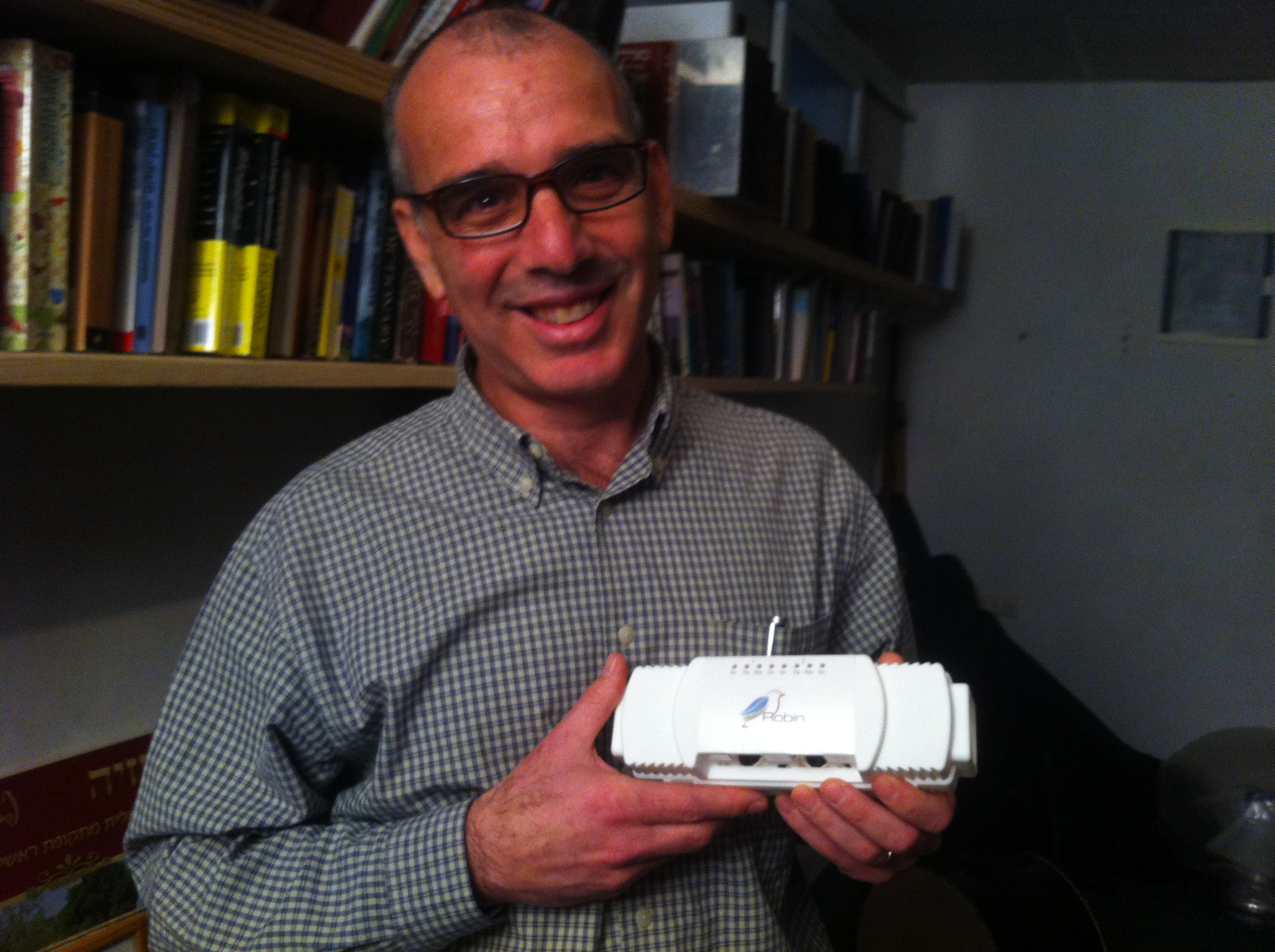
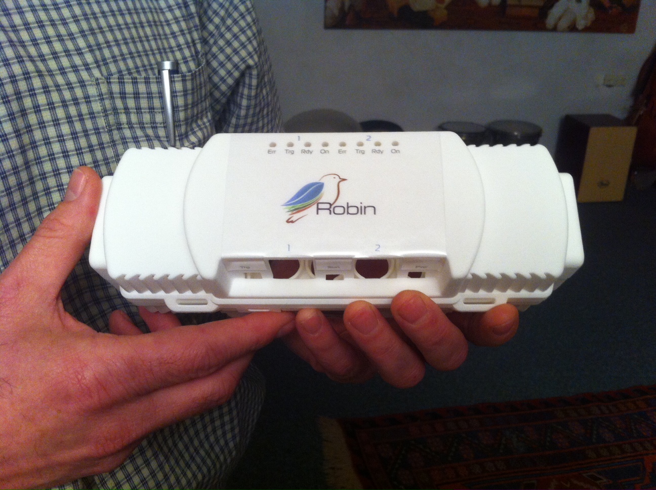
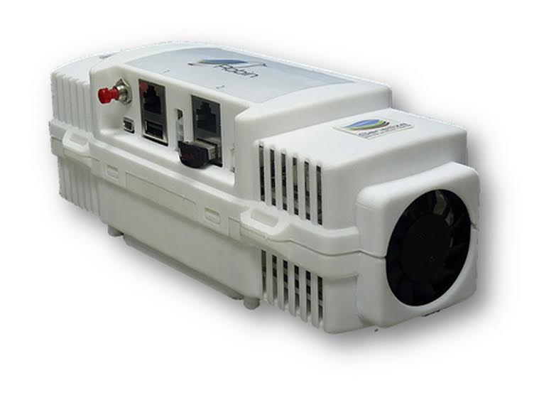
Today Sensilize offers the Robin system: one component is the Robin Eye, a small lightweight sensor about the size of a pencil case that is integrated into the drone. It collects raw data imagery so farmers, or those advising them, can make smarter and swifter decisions about crop management. When disease strikes, or when it’s time to harvest thanks Robin Mind, the software behind the sensors, can analyze the acquired data.
Just a few weeks ago the Food and Agriculture Organization’s director Jose Graziano emailed me saying that “Agriculture must change.”
Can this form of monitoring help change the way agriculture is managed? Stark is just back from the World AgriTech Investment Summit in San Francisco where he presented the Sensilize solution. He tells Green Prophet that he saw an enormous interest in his technology from CEOs of leading agtech companies and related industries.
 “Precision agriculture is going into the big farming operations. Everyone is looking to feed the world,” says Stark in an interview with Green Prophet. “We can’t provide our needs only by GMOs and biotech but also by better management.”
After a flyby with Robin on board Sensilize, the technology drills down using image processing to map vegetation mapping while conducting leaf analysis from above to see if there is any stress or deficiency in the crop or forest canopy.
Current solutions just take pictures of what’s going on below without any deep level analysis of what’s really happening, Stark tells Green Prophet.
“Others seem to deal with contours or geospatial issues. We are getting into the image and map looking at actual quantitative concentration of the pigment as a chemical lab, in a non-destructive way. All of this based on the “fingerprints” of the crops and soil.”
Getting to that point was an evolution inside the company:
“At first we wanted to develop applications to the consumer world, help you shop so you know which fruits are fresh and which are rotten, then we moved to the flower industry. After understanding challenges there we moved onto vegetation in the professional agtech market and matched this with drones.”
The mistake was actually buying a drone. “It was a flop because regulations globally are too complicated and the importance not rely with the platform of flying but with the data and the ability to transfer it precisely into actionable information,” says Stark.
“With this approach, we are now seeing interest from farmers, agronomists who manage farms, utilities companies and conservationists concerned about forest and land management practices.
“We wanted to create a tool that is available for use and which is simple. Drones are cost effective tools that are flexible. Whereas, satellites have problems with resolution and aircraft is expensive.
“We developed a solution that can be used by most of the drone platforms that exist in the market and once we decided this move everyone became our friends. So we knew that we were on the right track and that our end user wanted data analysis. Today we are one of the few companies that builds an application with sensors for vegetation mapping.
With seed money and later on another investment, both from the BLUE Private Equity Fund Stark and his team raised funds and started working.
Response from the world is that “Everyone from investors to innovators are looking to agriculture. The money is in the data. And with us drone companies can sell more drones. Some 15 plus UAV companies around the world have shown interest in integrating our sensor and using our solutions. Some of them have integrated it already and others are in the pipeline,” says Stark.
“We are bringing good data for actionable information. Taking this whole approach makes us unique. At the end of the day what is important for everyone it is the data..”
Others in the space include Airinov and MicaSense, which have both been acquired by Parrot.
Clients and users that already tested the Robin include Israel’s Jewish National Federation, the organization that plants trees in Israel. They want to use the system know about sick or diseased trees that may fall.
While the plan is not to put foresters out of business, Robin, ready for market this April, aims to arm foresters and farming stakeholders with a plan they can act on before disease or destruction takes root.
If that can save time, money, forest fires and prevent us from using dangerous pesticides we will be the first ones to fly with Sensilize.


How to make them better?
Have them spot GMO food and send a report to a web site the public can see.
Also install an open channel so we can destry them when they enter our private airspace!
Sensilize looks like a tremendous product. Agriculture is one of the sectors which is benefiting from all this new drone technology. Precision Ag management should save farmers many hours of work inspecting their crops. Drones can also be used to inspect farm buildings.