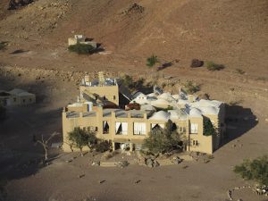
 Viganella is a village in Italy where the sun never shines. So locals installed a giant mirror to project the sun’s rays back onto them. Image via The Atlantic.
There are companies and apps that do it already from the comfort of your own home: you can check the solar panel potential output from your roof. Is the angle right? Are you on the grid? Are you in the right latitude or longitude or what does it all mean? What company do you choose? Type of solar panel? Local or from the big city? Contracts? Loans? There are lots of things to think about. Rather than have the individual homeowner or business brave it alone a new project out of Israel, masters of solar energy innovation and implementation, helps cities decide if they should go solar.
We already know the Middle East and Mediterranean can power the world with the sun’s solar power 3 times over. So what’s stopping us?
Knowing what cities work best for solar energy can help local planning councils offer tax incentives, attractive feed-in tariffs and market to the public for funds, grants or reimbursements. While there was a steep drop in greenhouse gas emissions over the first part of the year because of the coronavirus, the expectation is that the world will return to rising levels of emissions in the near future. We’ve had enough of cheap oil.
Alternative energy is a critical aspect in meeting reduction targets. Ben-Gurion University of the Negev researchers have developed an algorithm that predicts the best places to install solar panels on urban rooftops with 97% accuracy. Rooftop solar panels are considered the best way to utilize roof space, while weaning cities from dependence on fossil fuels.
The researchers combined ortho-rectified aerial photography (orthophotos) and LiDAR data to create an aspect-slope map.
Building rooftops are not uniform and the amount of solar radiation they receive is also variable. While previous tools provided some information, this is the first time an entire city could be mapped to such a high level of accuracy. Their findings were published in Remote Sensing.
The researchers, Profs. Arnon Karnieli and Isaac Meir, and Karnieli’s student, Arti Tiwari, used the southern Israeli city of Kiryat Malachi as their test site. They utilized an orthophoto produced by the Survey of Israel in 2012.

Digital Terrain Models and Digital Surface Models were created by an airborne light detection and ranging (LiDAR) map in 2015. After combining the data, an aspect-slope map was produced with a 97.39% accuracy.
As the climate crisis worsens, such practical tools are useful for the transition to renewable energy sources, already required by law in many OECD countries, the scientists report.
Zenith Solar, a solar company founded by David Faiman from Ben Gurion University, filed for bankruptcy in 2013. There was an explosion of solar energy companies starting around 2006 to 2007. The market burst in 2008, and it took basically un until now for costs to go down and financing mechanisms to find their right place.


