Project Pressure has created the first open source glacier archive, recording the environmental impact of climate change by documenting the world’s changing glaciers. Danish photographer Klaus Thymann launched this not-for-profit in 2008, garnering impressive street-cred with official links to the World Glacier Monitoring Service (WGMS) and the National Aeronautics and Space Administration (NASA). What’s this got to do with the Middle East? Some of the most endangered glaciers on the planet are in Iran.
The rugged mountains of Iran have shaped both the political and the economic history of the country, forming distinct valley communities that remained largely isolated until major roads were built in the 20th Century.
The Zagros Mountains boast peaks nearly 10,000 feet above sea level, and there are at least five snowy peaks higher than 13,000 feet in the south of Iran. Thymann recently led an expedition to survey of Iran’s glaciers. The project aims to raise awareness of climate change. It may also raise awareness of the spectacular geography of Iran.
Glacial ice is a major fresh water source in this arid nation, and glacial retreat is significantly affecting Iranian water supplies, especially critical as 60% of the country’s water resource for urban industries and agriculture stems from natural glaciers.
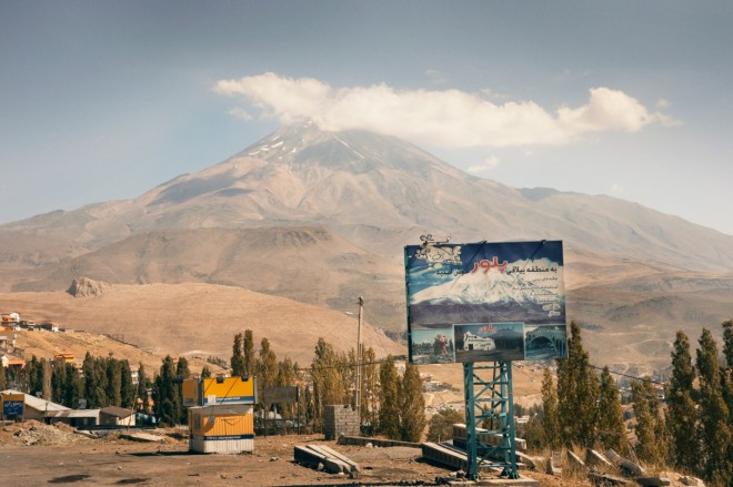
Mount Damāvand sits 41 miles northeast of Tehran, near the southern coast of the Caspian Sea. This highest peak in Iran (and the Middle East) boasts a potentially active volcano and holds a special place in Persian mythology. In the picture above, the glacier appears healthier on the billboard.
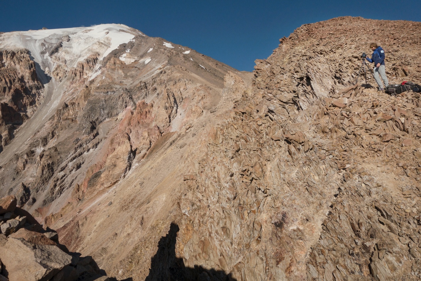
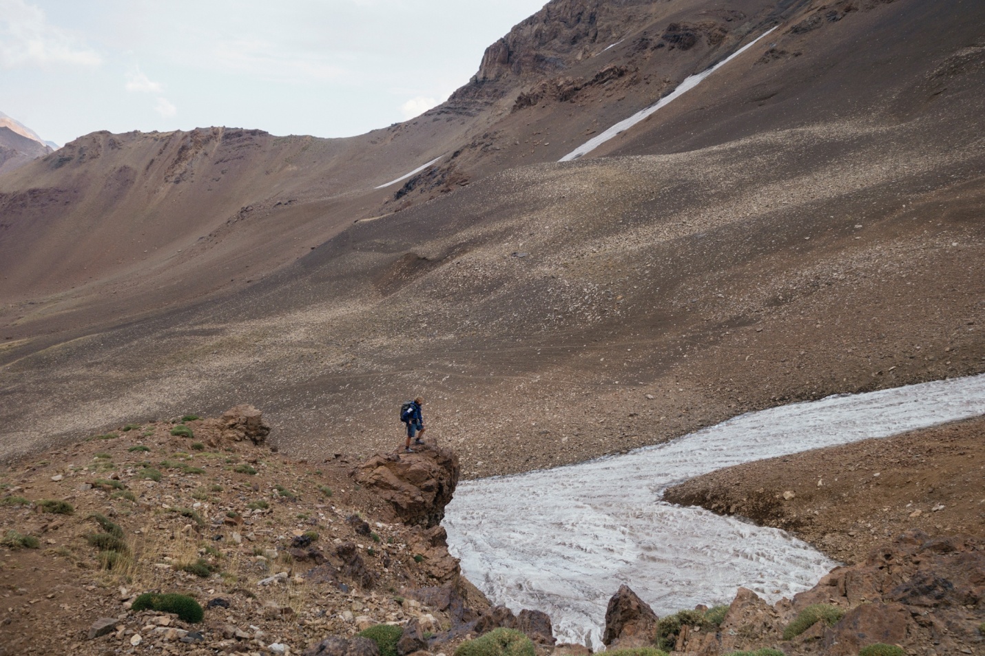
This image of Thymann setting up for a shoot gives a peak into glacial deterioration: the grey-colored rock surface leading off the summit shows where the glacier used to be.
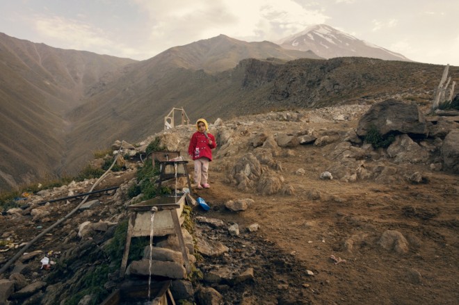
Local people live up on the mountain during warmer months, but move down slope when winter snows prevent animals from grazing at higher altitudes. Houses in the foothills tap directly into glacier melt for fresh water.

At 13,000 feet, there is clear evidence of diminished glacial surface. The exposed black ice indicates the melt is not thawing into glacier mass, which will further reduce the size of the glacier.
Four glaciers surround Iran’s second highest peak, jagged and near-vertical Alam Kuh (image above) in the northern Mazandaran province. The northern Alamchal glacier, western Split glacier, southern Khersan and Marjikesh glaciers are small in comparison to Damāvand.

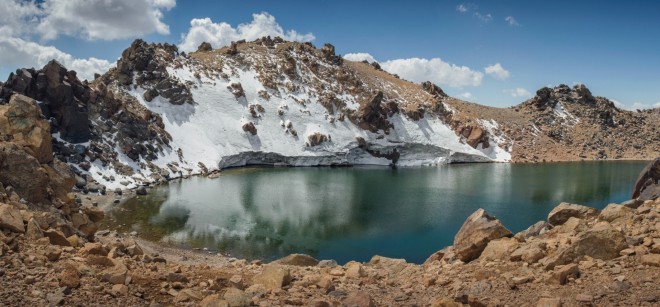
The Sabalan mountains in northwestern Iran are a popular destination for summer picnics, winter skiing, and all-year hiking. High up the mountain is the American Mosque. Built by American soldiers during WWII, it’s now used as base camp for locals wanting to summit Iran’s third highest peak, Mount Sabalan.
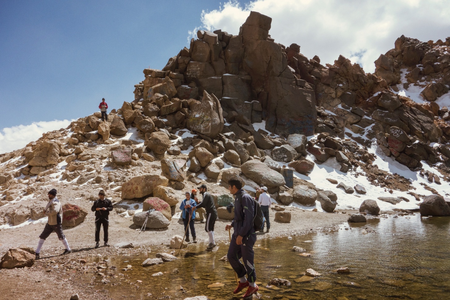
Mount Sabalan is a dormant volcano and its crater is now a small lake fed by the melting ice pack (see above, and lead images).
Thymann states on his website, “During the next decade many glaciers will retreat or disappear. Documenting these changing glaciers will provide future generations with a visual archive of the way the world was, and underscore the importance of preserving the balance of the world’s ecosystem. The next phase of the project will see the creation of ‘MELT’ – a digital platform which enables adventurers, scientists and members of the public to upload their own photos, allowing year-on-year comparisons of glacier change.”
Stunning earth portraiture that leaves us with the question, how many years of “year-on-year comparisons” are left?
All images by Klaus Thymann and Project Pressure


