 The European Space Agency (ESA) publishes satellite photos of Earth (and photos of space taken from Earth) in an incredible archive that’s updated weekly. Each image is paired with a brief explanation about what you’re looking at. Check out this selection – if the Middle East and North Africa (MENA) could take “selfies”, these would definitely be on its Facebook page.
The curving clays and sand soils of Iran’s salt desert, Dasht-e Kavir, can be seen in this shot (above) from the Ikonos-2 satellite. According to the ESA, satellites can directly identify different minerals and recognize large-scale geological structures related to mineral deposits that are undetectable by ground-based surveys. Iran is one of the world’s most important mineral producers.
The Sahara Desert comprises most of Libya, leaving only 6% of its land suitable for agriculture. Libya has no permanent rivers or natural inland water bodie. For fresh water, the country relies upon its vast fossil aquifers which formed 10,000 years ago in a very different climate when ancient rivers and lakes were regularly replenished with heavy rains. Water saturated subsurface sandstone, penetrating as deep as 4 km, forming the enormous underground water basins that now supply Libya’s water.
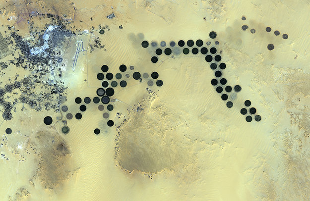
The Al Jawf oasis (pictured above) in southeastern Libya lies deep in the Sahara. The city appears in the upper left corner, and the Braille-like dots are irrigated agricultural plots often a kilometer-wide. Their circular shapes result from central-pivot irrigation systems, where a long water pipe rotates around a well at the center of each farm. The area receives almost no rainfall, and relies solely on fossil water pumped from deep underground.
Japan’s Advanced Land Observing Satellite (ALOS) captured this image with its Advanced Visible and Near Infrared Radiometer type-2, which charts land cover and vegetation in the visible and near-infrared spectral bands at a resolution of 10 m.
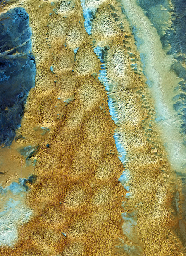 This image from the Ikonos-2 satellite shows the sandy and rocky terrain of the Sahara desert in western Algeria, Africa’s largest country. Major oil and natural gas deposits lie beneath the desert, which comprises 90% of the nation’s landmass, underpinning Algeria’s position as one of Africa’s wealthiest countries.
The closest town to the area pictured above is Taghit in the province of Béchar. The town’s economy is built on tourism, with travelers drawn to the area’s large sand dunes – the main feature of the Sahara’s Grand Erg Occidental, a enormous sea of rolling sand formations.
Taghit National Park was established in 2007 to curb advancing desertification and protect wildlife. The project seeks to guard grasslands, restore palm groves, and reforest degraded land. The region receives less than 25 cm of rainfall per year.
This image was acquired at a spatial resolution of 4 m by the commercial Ikonos-2 satellite.
Check out the ESA archives for more stunning photography, but be warned, it’s addictive.
All images from the European Space Agency


Comments are closed.