We love the Heschel Center for reminding us about their fundraiser: Hike Bishvil Yisrael – March 23-27, 2008.
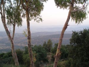
Israel’s outdoor scenery is breathtaking, writes Heschel, “and there is no better way to see it than with the people working to preserve it.
“This is an opportunity for a unique, challenging and rewarding Israel experience and a chance to literally ‘walk the walk’ for a sustainable Israel.”
If you’re new to the country, or want to come for a visit, the hike could be a great place to meet some of Israel’s cream of the “green” crop. We assume the cash raised will go to the Heschel Center and Hazon.
For your convenience, we have posted an itinerary here on GreenProphet, but mosey on through to the end for the hike’s website contact information. Registration in the hike comes with a commitment of raising a few $K, so apply only if you are serious.
Participants are encouraged to arrive in Israel before Sunday, March 23. 2008 marks Israel’s 60th anniversary and the country will be filled with celebrations.
March 20-21 mark the festival of Purim, a joyous celebration in Israel. Participants who would like to come to Israel in advance of the hike who need help planning their trip should contact [email protected].
THE ITINERARY DEETS
Day 1: Sunday, March 23th: Travel and Orientation
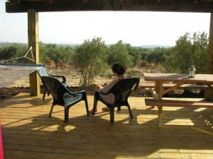
 Participants are encouraged to arrive in Israel before Sunday. There will be a coach bus available from the Ben Gurion airport at 1 pm and 5 pm to bring participants to Ma’alot. Participants wishing to arrive in Ma’alot will be able to take the train to Nahariya and will be picked up by a shuttle bus. Sunday will be dedicated to community building, registration and orientation. Participants will enjoy the accommodations in the Hacienda Forestview.
 Ma’alot was created as a “development town” for Jewish immigrants from Romania, Iran, and Morocco, in 1957. In 1963, Ma’alot was merged with the larger Arab village of Tarshiha, and the unified town was renamed to reflect both origins. Tarshiha is mentioned in Crusader times (12th and 13th century) as an inhabited location. During the Crusades, several battles between Christian crusaders and Arab Muslims took place in the area.
Day 2: Monday, March 24th: Ramot Naftali to Mount Meiron- 8.6 miles (13.75 km)


Day 3: Tuesday, March 25th: Mount Meron to Tzfat – 10 miles (16 km)
 Participants will begin the day with a gentle climb, winding through a forest 300 meters, to the top of Mount Meron. Mount Meron is the highest mountain in Israel, outside of the Golan Heights. The grave of Rabbi Shimon bar Yochai, a famed Talmudic rabbi and author of the mysitcal text the Zohar, is located on the slopes of Mount Meron. Leading up to the anniversary of his death on Lag B’Omer, thousands of people camp out along the slopes near the tomb, and on Lag B’Omer itself, hundreds of thousands make pilgrimages to celebrate the occasion.

The expertise in this field was brought to Tzfat by Jews expelled from Spain and Portugal; they had first settled in Salonika and Adrianople (Edirne), where they learned the trade. The path ends with at the shallow Sechvi pools, which contain water all year round, create a charming little corner of the riverbed. Large plane trees are reflected in the clear water, and there are also fig trees, an abandoned flour mill, and a cave. As we leave these pools we will begin the steep ascent to the mystical and ancient city of Tzfat. At 3,000 feet above sea level, participants will enjoy the five-start accommodations of the Tzfat Rimon Inn & Spa.
Day 4: Wednesday, March 26th: Tzfat to Hokok – 8.5 miles (13.5 km)

Our path will take us through springs and lush vegetation before the wadi becomes almost desert-like leading up to the rock pillar (amud), from which the valley draws its name.
We will finish the day with an uphill climb to Kibbutz Hakuk-Balev where we will enjoy breathtaking views of the Kinneret and warm kibbutz hospitality.
Day 5: Thursday, March 27th: Hokok to the Kinneret – 5 miles (8 km)

For those who need to return directly to the airport, we will provide a bus from the end point to Ben Gurion (there will be opportunities to change beforehand).

For more information on how to register, for what looks like a once in a lifetime experience, go to: www.hikeisrael.org.


One thought on “Walk the Walk for Israel’s Environment”
Comments are closed.