 We’ve killed it! Once the fourth largest lake in the world, the Aral Sea between Kazakhstan and Uzbekistan is about 10% of its former size.
Is it our love for cotton or Soviet mismanagement? See the individual images below of a dying saltwater lake in progress.
What’s left of the Aral Lake one of the strangest sights, Green Prophet’s Larry told me two weeks ago, while reflecting on his trip ther: Ports and boats stuck at “harbor” in the middle of the desert as shown in the images below. Located in the arid plains between Kazakhstan, Uzbekistan, and Turkmenistan, the Soviet Union had great plans to build a cotton empire and diverted water from the Aral Sea to irrigate crops.
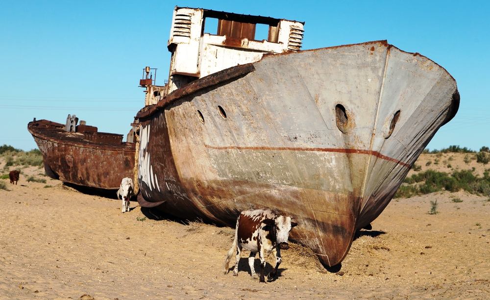
Out to pasture at the Aral Sea:
Aral Sea in 1964:
Aral Sea 2014:
The region’s two major rivers which are fed by both snowmelt and rain in faraway mountains were used to “transform” the desert into farms for cotton and other crops.
Once, the Syr Darya River and the Amu Darya River flowed down from the local mountains, passed through the Kyzylkum Desert, and met at the Aral Sea, which is actually an inland saltwater lake, at the lowest part of the basin.
While irrigating from its waters helped the desert bloom, thanks to Soviet-era enterprise, it has devastated the Aral Sea.
NASA’s Moderate Resolution Imaging Spectroradiometer (MODIS) on NASA’s Terra satellite have documented the changes. Let’s see how fast the devastation happened over the last 15 years.
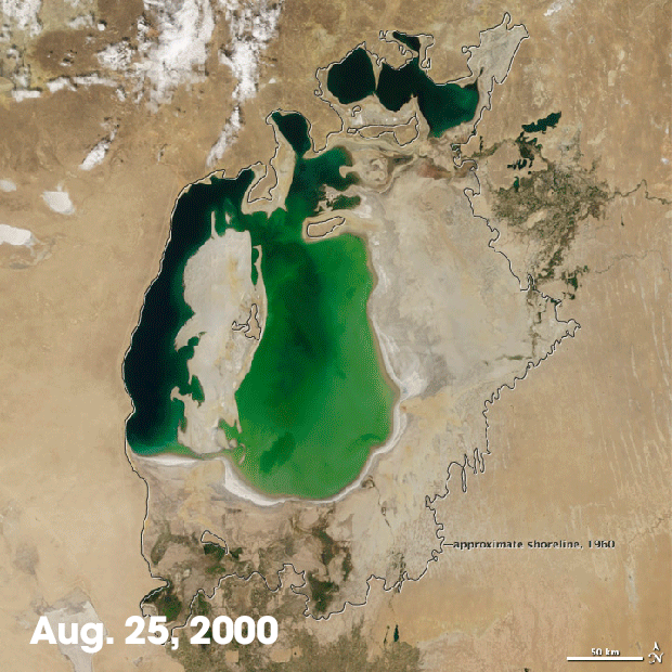
By 2000 the Aral Sea was already only a fraction of its 1960 levels. The Northern Aral Sea (or the Small Aral Sea) had already separated from the Southern (Large) Aral Sea.
Aral Sea in 2000:


By 2001, the southern connection had been severed.
Aral Sea 2001:
In 2005 a drought started and then cut off the flow of the Amu Darya to the Aral Sea.
Aral Sea 2004:

Aral Sea 2006:

Aral Sea 2008:

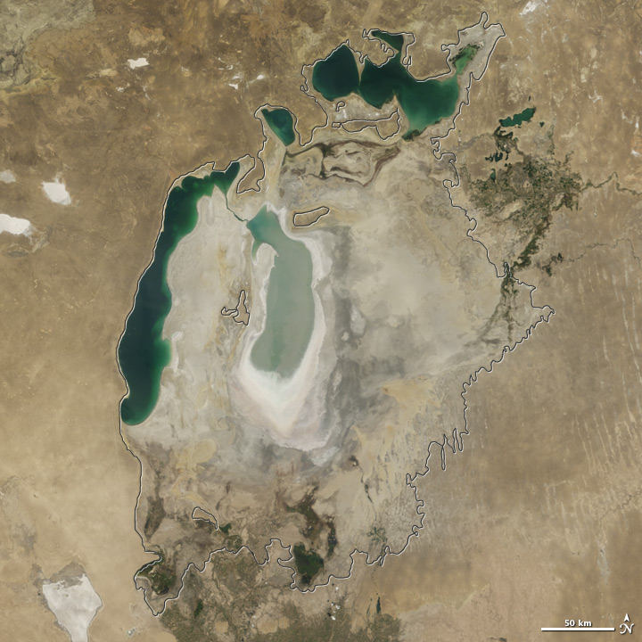
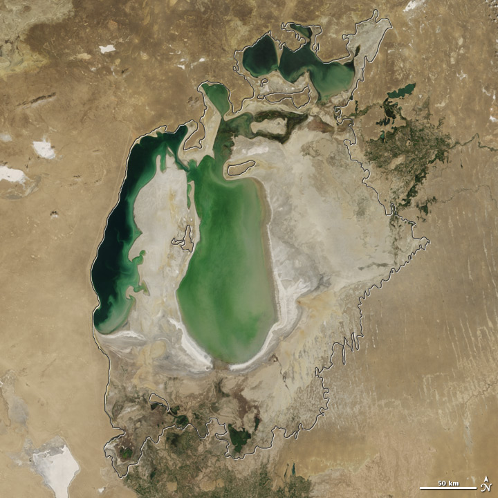
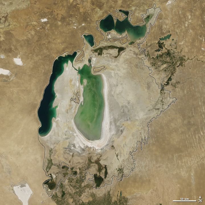
Between 2009 and 2014 there were alternating dry and wet years.
Aral Sea 2012:
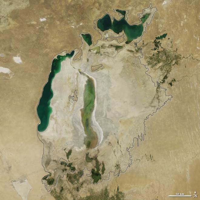

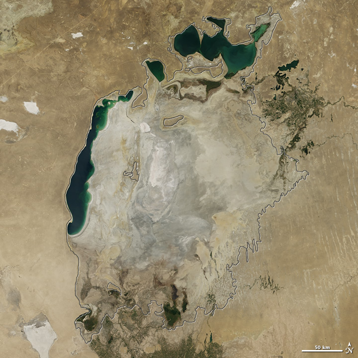
Aral Sea 2014:
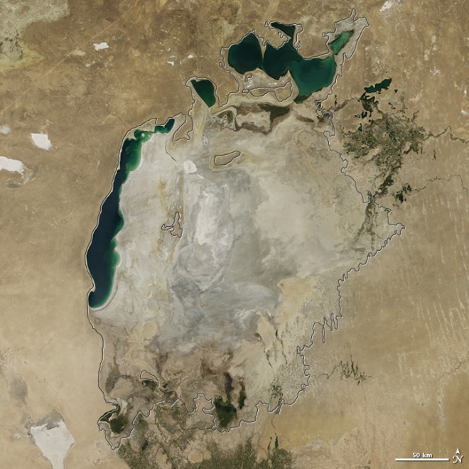

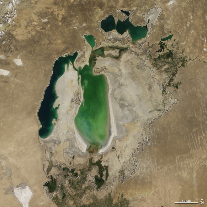
In 2014 the eastern lobe of the Aral Sea dried up completely. If it weren’t for NASA documenting and publishing these kinds of reports, then who?
RELATED: Iran’s Lake Orumiyeh is drying up
You see, as the lake dried up local people did take notice because their livelihoods changed. Fishing died out and the water became over saturated with pesticides and pollution. Now blowing dust from the Aral Sea lakebed which is full of chemicals is contaminating the air that people are breathing.
More facts about the Aral Sea:
Crops now need more water to counteract over salty soil.
Without the lake summers are hotter and winters colder.
Kazakhstan built a dam between the upper and lower sections of the Aral Sea in 2005, but it didn’t work.
We still haven’t figured out that reengineering planet earth might not be a hot idea.
Satellite images by NASA; cow at Aral Sea from Shutterstock
Author: Karin Kloosterman
Karin Kloosterman is an award-winning journalist and publisher that founded Green Prophet to unite a prosperous Middle East. She shows through her work that positive, inspiring dialogue creates action that impacts people, business and planet. She has published in thought-leading newspapers and magazines globally, owns an IoT tech chip patent, and is part of teams that build world-changing products to make agriculture and our planet more sustainable. Reach out directly to [email protected]


One thought on “See how Asia’s Aral Sea shrinks before our very eyes in these time lapse photos”
Comments are closed.