The ‘historical imagery’ function on google earth is particularly helpful in tracking changes to landscapes since about the turn of the millennium when satellite imagery became commonly available.
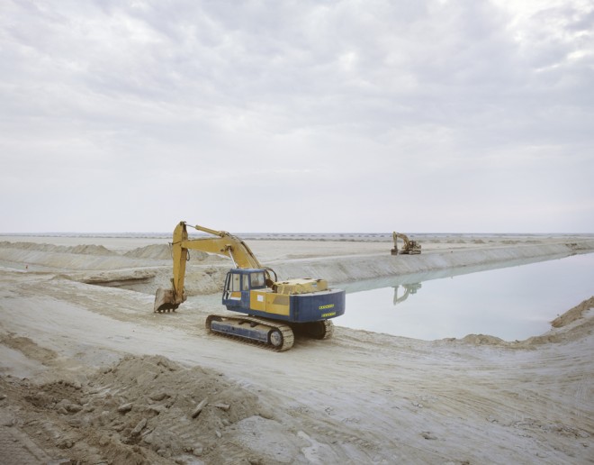
For instance, it has allowed me to estimate that the army of earth-moving vehicles that I saw at work have been excavating this site west of Abu Dhabi for almost a decade. The area of the development extends to roughly 39 square miles. The carbon footprint of this project defies belief.
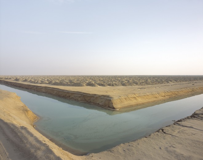
The landscape was originally a large tidal sabkha plain. The developers had to first construct a sea barrier around the whole area, allowing the diggers to move in and lower the ground level.
A network of deep channels was created and then flooded through pipes before the removal of the sea barrier, allowing the area to become tidal again. The channels allow a deeper penetration inland of the high tide and make the whole ‘swamp’ navigable.
Related: Massive concrete amphitheater lies disused outside of Dubai
The process is currently being repeated on further areas, and the waste created by the excavations is being laid over the adjacent sabkha plain, raising the ground level and, presumably, creating an area suitable for future development.
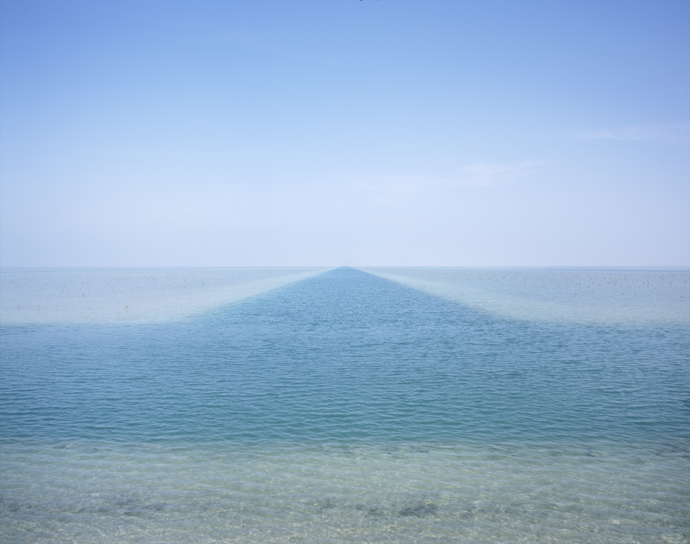
‘Beds’ created by the channels have been planted with mangrove shoots, although with limited success so far. It is the stated aim of the Environment Agency to expand the Emirate’s mangrove forests. In fact, at least two million mangroves are slated to be planted along the coast by the end of this year.
Mangroves are known to store carbon efficiently and provide rich environments for wildlife. Many natural mangrove areas have been impacted upon by development around Abu Dhabi island.
I find tragedy in many aspects of this project: the destruction of a natural landscape, the excruciating regularity of the channel grid system and, of course, the energy consumed in order to create it, to name but a few.
Maybe it will eventually become a valuable environmental asset. But even if it does, it will always be there to stand testament to man’s fossil-fueled subjugation of nature.
Please see for yourself the breath-taking scale of this project on google earth at 24° 6’26.77″N 53°57’0.02″E
Note from the editor: this photograph is part of a series called “Consumption” that seeks to document consumerism’s impact on the environment. From resource extraction and commodity production all the way down the supply chain to retail stores and waste processing facilities, Richard artfully examines what nature has come to mean in a world that depends on buying stuff.

Author: Richard Allenby Pratt
Richard is a British photographer living and working in Dubai, UAE. His concerns about the sustainability of the way we live and our economic systems only really became urgent after the birth of his son in 2008. As a landscape photographer he found the obvious way to express these concerns was by making photographs of the places impacted on by human activity, and particularly those places that best display the terrifying scale of our consumption. His basic method is to study google earth and then visit the most intriguing and inexplicable places thereby discovered.


