Iran is home to two of the world’s largest deserts. But the country needs better planning to block these deserts from growing.
Desertification threatens biodiversity and reduces productivity capacity of land. Most of the land of Iran is located in arid and semi-arid climates and most of Iranians live in the most livable places outside the arid lands. So this makes it hard to develop an adequate regional planning, national-wide land-use planning, and use the productivity of all of the parts of the country.
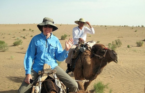
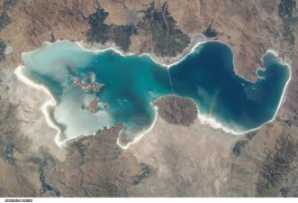
The Central parts of Iran includes two deserts: Dasht-e-Kavir (the Great Salt Desert – above) and Lut Desert (below) which are among the largest deserts of the world. Dasht-e Lut, also spelled Dasht-i-Lut, is a large salt desert in southeastern Iran and is the world’s 25th largest desert.

The climates of deserts can seem different from each other. The north-African desert (Sahara), which is the biggest in the world, contains extremely hot temperatures, while the Gobi Desert in Mongolia is the coldest one.
The average rainfall in the Iranian deserts are about 50 millimeters per year, while the average for the whole Iran is 320 millimeters. The Iranian rainfall average is about one third of the one for the world.
Parsi Times cites these main reasons:
- The population has doubled during last 25 years (since 1979).
- More agricultural and pastoral products have forced people to use land extensively or convert forest and rangelands to cultivated land.
- Over use of wood and plants as fuel for household cooking and heating and use of natural regulation tends to denude the soil and intensify desertification.
- Denuded soil is exposed to wind erosion and shifting sand dunes destroy orchards, gardens, farming lands and threaten industrial and economical centers and leads to total collapse of economy, devastation of the environment, abandonment of settlements and migration of people to other cities and residential centers.
The central Iranian Plateau is a hot-arid land with very low rain fall average. Eighty percent of Iran is of the semi-arid and arid climate. The remaining 20 percent is located in the north along the Caspian Sea, which has a Mediterranean climate with lots of rains, and also in North West of Iran – Zagros Mountains, which has acceptable rainfall caused by the western winds. The importance of the problem is in the interactions of population, infrastructure and desertification.
This is why the non-desertification plans have been discussed over during the past years. Of course the first plans of this kind were executed in 1940’s. Up to 2009, about 26,100 hectares of the hot, desert lands in central Iran were covered by planting heat-resistant trees and bushes. But the necessity of implementing more powerful strategies for blocking desertification is felt.
Read more on desert climates:
Water Problems in Cyprus Worse than Those of Israel, Syria and Lebanon
Morocco to Stave off Desertification with New Environmental Charter
Thailand to Help Jordan Make Artificial Rain
Top mage via hamed
Lower image via indigoprime


